Big Timber, Mont., to Pocatello, Idaho

Every once in a while on a long trip you have a day where nothing goes wrong. That happened today. In fact, today was as close to perfect as I’ve gotten on any cross-country trip. I got up on time, and got on the road on time. The drive was easy, with little traffic and no delays. I arrived at Camas National Wildlife Refuge at four o’clock, with at least four hours to spend there.

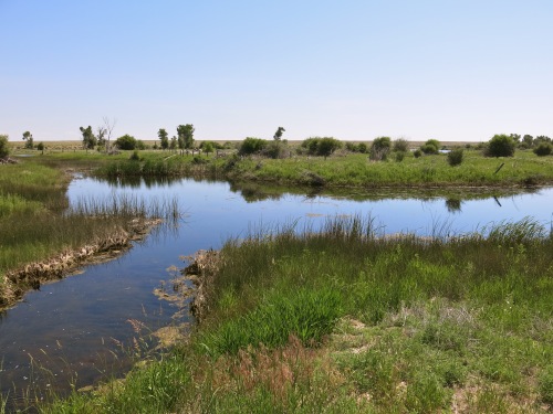
The refuge consists of over ten thousand acres of varied habitat — open water, marsh, seasonally dry ponds, uplands with bunch grass and sage brush — along Camas Creek. The refuge provides habitat protection for breeding and migrating birds, but hunting and agriculture are also allowed in parts of the refuge.

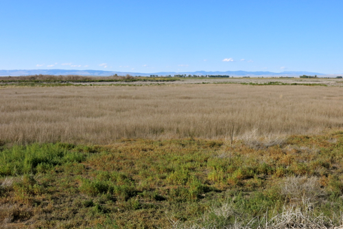
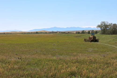
Agricultural use of Camas N.W.R.

The weather was perfect, with a temperature of 79 degrees, dry air, light variable breezes, and perfectly clear skies. Almost as soon as I pulled into the parking lot near the refuge headquarters, I flushed a Common Nighthawk from where it was roosting in a tree, and with the sight of it circling around over me calling with a plaintive “peent, peent,” I found myself detached from any thought of workaday affairs. And it got better from there. When you come across inviting green marshlands with large areas of open water in what is close to being a desert landscape, with just over ten inches of precipitation a year, it is an amazing and refreshing sight.

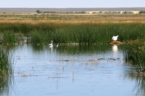
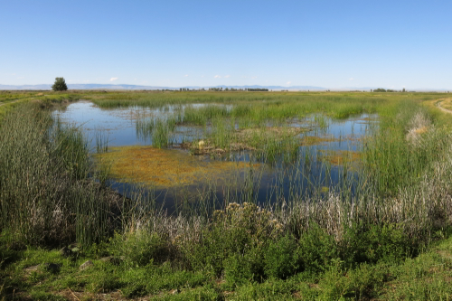
Flooded pool in Camas N.W.R.

The marshlands were teeming with birds. Admittedly, most of them kept far away from me, and I would have seen more birds if I had had a scope. But the light was excellent, and I could make out many of the birds I saw, even from a distance. I saw a good number of birds that had hatched this year. I saw two Trumpeter Swans accompanied a cygnet, a great many Mallards with ducklings, and lots of American Coots with their young — these three species are captured in the photo below, about as they appeared through my binoculars — as well as many other juvenile birds.

Camas N.W.R.

The refuge staff manage the water levels in the pools to maximize food sources, and several of the ponds had been allowed to dry out. These dry ponds looked stark and lifeless at first.

BlogJul2915d

But a closer look at one of them revealed five Pronghorn Antelope — four adults and one juvenile — who were watching me cautiously. I stood watching them watching me, and as I did so a car drove by without even slowing down. A little boy looked at me through the rear window, and I wanted to tell him to tell his parents to turn around and come back and look — but then I got distracted by two juvenile Northern Harriers flying low over the dry grass.

If there was a disappointment in an otherwise perfect day, it was that I didn’t see any Sage Grouse, even though I spent half an hour walking along a trail in the upland habitat near dusk. These uplands hardly merit the name based on elevation, for they are only about ten feet above the level of the marshlands. But that ten feet is enough: the soil is dry gravel, and the vegetation is dominated by short bunch grass — dried a crisp brown in late July — and sagebrush. But I was more than compensated by this disappointment a little later. While I was sitting eating my picnic dinner, with the sun about to set behind the distant mountains, two Swainson’s Hawks tried to roost in nearby trees, only to be repeatedly attacked out by brave Western Kingbirds, and after ten minutes finally driven away, screaming loudly. It was a dramatic conclusion to the day.

I suppose if you are not all that interested in birds, this may not sound like an almost perfect day. Really, though, looking for and identifying birds wasn’t the point. I think we human beings are meant to be outdoors as much as possible, and we are meant to be interacting with other living things as much as possible; evolution has shaped us to this end. Computers and automobiles and toilets and hospitals have made our lives easier and longer and more comfortable, but not necessarily better and more soul-satisfying.

Posted a day late due to poor Internet connection.

Dickinson, N.D., to Big Timber, Mont.

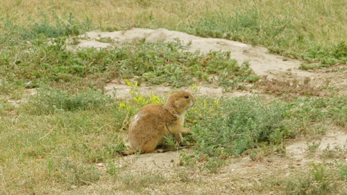
The wind storm from yesterday continued unabated. The National Weather Service warned of sustained winds of twenty to thirty miles per hour, and gusts up to sixty miles per hour. It was an unpleasant drive from Dickinson to Theodore Roosevelt National Park, and I was glad to park the car at the trailhead for the Paddock Trail. As soon as I parked the car, I realized that I was right next to a Prairie Dog town; thirty feet from the car, a Prairie Dog sat feeding at the entrance to a hole, warily keeping an eye on me.

Prairie Dog

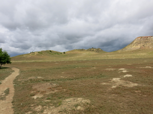
As i looked around me, I saw more and more Prairie Dog holes, lighter-colored mounds of earth dotting the close-cropped vegetation. The mounds started near the edge of a creek and extended up a gently sloping plain to the foot of a butte.

Prairie Dog town

I estimated that the town covered an area of several acres. I walked up the Paddock Trail to the end of the town. Wherever I walked, a Prairie Dog would give a shrill alarm call, poised at the opening of a hole, ready to dart down inside when I got too close. I saw a pair of Mountain Bluebirds and an immature American Robin hopping around in between the holes; perhaps they were feeding. As the ground rose beyond the edge of the Prairie Dog town, I was more exposed to the full force of the wind, and to occasional spatters of light rain. It wasn’t fun, so I turned back, and decided to try the Jones Creek Trail. It turned out to be a little bit more sheltered, and I walked in for about half an hour, beneath the protecting buttes and amid the sagebrush.

BlogJul2815c

Two female Northern Harriers flew above me, one apparently pursuing the other, twisting and turning through the tree tops, screaming at each other in the face of the high wind. I wanted to just keep walking for the rest of the day, but I had to drive halfway across Montana before nightfall, so I headed back.

When I was almost to the car I saw two people with binoculars around their necks. “Did you see the Harriers?” I said excitedly. They looked at me blankly. “Harriers?” said the man. “You’re not birders?” I said, pointing to the binoculars. “No,” said the man, with undisguised scorn. “Never mind,” I said, and didn’t bother to tell him what he had missed.

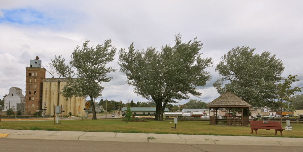
I stopped in Beach, North Dakota, for lunch; I avoided the fast food joint right next to the highway and drove a mile into the town and found La Playa Restaurant was open. In the restaurant, classical music was playing, and the young woman at the counter said, “Sit wherever you want, but not at a table that’s not clean yet.” A man with a graying pony tail sat across from a thin middle aged woman and talked about people they knew. An older woman with a grumpy face said to a young waitress, “There’s no lettuce left at the salad bar. The eggs are gone, too.” I ordered a small steak, medium rare. “Here’s your steak, darling,” said the waitress, and it came cooked perfectly. An elderly man and woman walked in, having a conversation that I’d describe as eccentric, with leaps of logic that I couldn’t follow. It was after two o’clock, and the music switched to a country rock radio station. The grumpy-faced woman ate methodically and stoically. I paid my bill, left the restaurant, and drove around a couple of blocks of downtown Beach. The town had a friendly feeling to it, and I particularly liked a hand-lettered sign in the park: PET POOPS YOU SCOOP.

Beach, N.D.

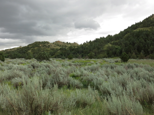
The highway wound through the buttes and over the rivers and creeks of Montana. I was driving right into the teeth of that strong wind, so strong that the car was using about a fifth more gas than usual. I stopped for gas, and kept driving: a broad plain with cultivated fields; fantastically eroded buttes; a glimpse of a river with muddy water; softly rounded buttes; huge rolls of hay; cattle at a water hole; a small valley with a cluster of ranch buildings and trees whipping in the wind; another creek; another butte; the landscape passed by, always a little different, slowly changing as I drove onwards, the big sky overhead. I had a recording of of Terry Reilly’s minimalist masterpiece “In C,” and it seemed to fit the passing landscape perfectly: slowly changing, a sense of excitement and discovery slowly waxing and waning.

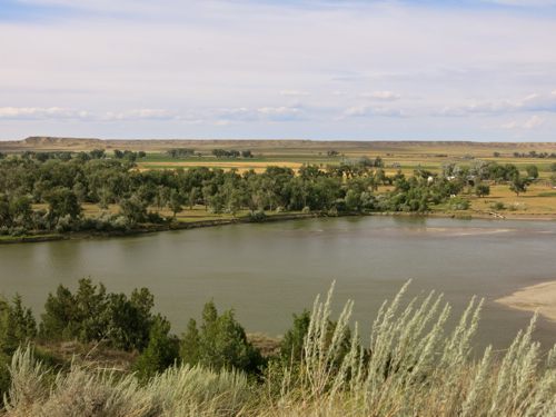
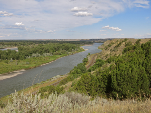
I stopped for a moment at a roadside rest area where I looked out over Rosebud Creek. The old Chinese art critics said the highest form of landscape painting depicted a landscape that you could wander in. This was a landscape you could wander in: the railroad winding between a cliff and a river; a large island in the river; ranch buildings just visible hear an there among the wide-spaced trees; mysterious bluffs in the distance leading to a hidden prairie beyond.

Rosebud Creek

Rosebud Creek

Rosebud Creek

By the time I reached Billings, I had to buy gas. Carol had said Billings was worth stopping in. Had Carol been with me — Carol, that best of traveling companions, who always knows where the interesting places are to be found in any city — I’m sure I would have found the funky quarter where there are good cheap restaurants, a farmer’s market, a used bookstore, and a coffee shop with free wifi. But since Carol could not come on this trip, all I found was a supermarket and a gas station.

This post is for Carol, who asked for lots of photos.

Evanston, Wyo., to Big Springs, Neb.

About an hour from Evanston, I got off the interstate and headed north on state route 372. I drove over a rolling sagebrush-covered landscape; here and there along the road I could see the usual sights of the West: a railroad siding with a string of covered hoppers; a fence and gate with a sign saying something-or-other mine and huge piles of tailings in the distance; some kind of industrial complex blowing white smoke; and so on. Martin Heidegger talked about “enframing,” the way our technological society divides up the world with maps and grids, marking where there are resources we want, where we can run roads and railroads and pipelines, where we can enjoy recreation opportunities, where we can set aside some land for wildlife. I was heading to a national wildlife refuge that was created when the Green River was dammed, and a place had to be found for some of the displaced wildlife.

About a half hour from the interstate, I was pulling in to the headquarters compound of the Seedskadee National Wildlife Refuge. I walked down a low bluff about thirty or forty feet high, into the broad basin of the Green River, and suddenly there was life all around me: horse flies buzzed my head, Violet-green Swallows flew overhead, Marsh Wrens and Red-winged Blackbrids calling in the cattails, birds and insects everywhere. In dry Wyoming, water means life, and water flowed throughout the basin, in human-made channels through the highly-managed wetlands.

BlogJun2915a

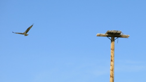
I walked down one trail, but it got swallowed up in lush, thigh-high grass — besides which, I was obviously disturbing some Killdeer, who must have had a nest nearby, since they circled around me calling repeatedly, trying to distract me from wherever it was their nestlings were. The Green River was rushing by, little pockets of turbulence marking its surface. A Cinnamon Teal burst out of the rushes and flew away. An Osprey sat in a nesting box on top of a tall telephone pole, and I walked towards it for a closer look. But it grew increasingly agitated, and began to fly in circles around the nest, so I retreated again.

BlogJun2915b

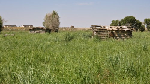
The remnants of an old log cabin and some agricultural implements were almost lost in the grass. I stopped to look at them for a moment, the new buildings of the refuge headquarters in the distance, and thought about how humans of European descent had made use of this land for a century and a half.

BlogJun2915c

What I really wanted to do was talk over what I had seen with my father, but he really can’t talk on the phone any more. He likes wetlands as much as I do — Great Meadows National Wildlife Refuge is one of his favorite places, and the last place he took a real walk outdoors — and he would be interested in the birds I saw. When I see him in a few days, I’ll tell him about Seedskadee, and show him the photos I took.

Seedskadee N.W.R. was the highlight of my day; everything else was an anticlimax, even though I drove through some fantastic scenery. I already want to go back, and spend a week there, and fish in the Green River, and maybe see some Sage Grouse on their leks.

Elko, Nev., to San Mateo, Calif.

Nights get cool in the dry desert air of Elko, and we left the window of the motel room open all night. We got on the road while the air was still cool. We were about to turn on the audiobook we have been listening to — Chaucer’s Canterbury Tales, in the translation by Burton Raffles — when I saw a sign by the side of the road: “California Trail Interpretive Center.”

“Do you mind if we stop there?” I said to Carol. She knew that I have become mildly obsessed with the California Trail on this trip, so she agreed we could stop.

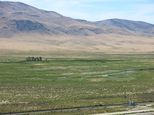
We climbed up the short trail behind the Interpretive Center building, and looked down on the Humboldt River valley: the narrow river winding along the low point of the broad valley; bright green grass and even a few trees growing near the river; the green grass giving way to sagebrush as the land sloped up away from the river; and then, rising more and more steeply above the level of the sagebrush, the stark and almost bare slopes of towering mountains.
BlogJul2614a

Above: The Humboldt River valley east of Elko, Nev.

Edwin Bryant, in his 1848 book What I Saw in California, described how his party made the difficult crossing of the salt flats west of Great Salt Lake, and then made their way across the often steep and difficult terrain of what is now western Nevada, finding barely enough water, and barely enough grass for their mules, at widely spaced springs. After more than a week of travel through this harsh desert, Bryant and his party found a small tributary stream which finally led them to the Humboldt River (which they called Mary’s River):

“We emerged into the spacious valley of Mary’s River, the sight of which gladdened our eyes about three o’clock, P.M. At this point the valley is some twenty or thirty miles in breadth, and the lines of willows indicating the existence of streams of running water are so numerous and diverse, that we found it difficult to determine which was the main river and its exact course…. At sunset we encamped in the valley of the stream down which we had descended, in a bottom covered with the most luxuriant and nutritious grass. Our mules fared most sumptuously both for food and water.”

Today, the Humboldt River valley looks somewhat different than it did in Bryant’s day: the river has been restricted to one main channel; most of the trees are gone and the river bottoms are used by farmers to grow feed for cattle; cattle graze on sagebrush above the river bottom; and the interstate highway and a railroad run between the agricultural land and the grazing land. But even in this time of interstate highways and air conditioned automobiles, I still found the green of the valley to be a welcome sight in the midst of a land that appeared to me to be dry and forbidding landscape.

My perception of this land as dry and forbidding is not shared by the Te-Moak Tribe of Western Shoshones. On their tribal Web site, they write: “This vast land of mountains, valleys, deserts, rivers, and lakes offered an abundance of wildlife and plants for the Shoshone to hunt, fish, and gather. The Newe [the name by which they call themselves] knew their lands and cared for its natural balance; for them it was a land of plenty.” And, Steven J. Crum, in his book The Road on Which We Came: A History of the Western Shoshone (Salt Lake City University of Utah Press, 1994), quotes a Western Shoshone song:

“How beautiful is our land,
how beautiful is our land,
forever, beside the water, the water,
how beautiful is our land.

“How beautiful is our land,
how beautiful is our land,
Earth, with flowers on it, next to the water,
how beautiful is our land.”

We kept driving west, generally following the course of the Humboldt River, for the next two or three horus. Bryant and his party followed the Humboldt River for more than a week, from August 9 through August 19, when at last they reached the Humboldt Sink — that place where the river terminates:

“We came to some pools of standing water, as described by the Indians last night, covered with a yellowish slime, and emitting a most disagreeable odor. The margins of these pools are whitened with an alkaline deposit, and green tufts of a coarse grass, and some reeds or flags, raise themselves above the snow-like soil.”

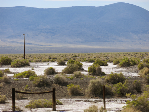
The Humboldt Sink is another weird landscape, forty-five miles of undrinkable water, halophytes or salt-loving plants, whitish soil — and forty-five miles of misery for the early travelers along the California Trail. The Western Shoshone appear to have been smart enough to stay out of the Humboldt Sink. But the white emigrants had to cross it in order to get to California. Mark Twain had to cross it in his 1861 trip by stagecoach in order to get to his final destination of Carson City:

“…forty memorable miles of bottomless sand, into which the coach wheels sunk from six inches to a foot…. It was a dreary pull and a long and thirsty one, for we had no water. From one extremity of this desert to the other, the road was white with the bones of oxen and horses. It would hardly be an exaggeration to say that we could have walked the forty miles and set our feet on a bone at every step! The desert was one prodigious graveyard. And the log-chains, wagon tyres, and rotting wrecks of vehicles were almost as thick as the bones. I think we saw log-chains enough rusting there in the desert, to reach across any State in the Union. Do not these relics suggest something of an idea of the fearful suffering and privation the early emigrants to California endured?”
BlogJul2614b

Above: The Humboldt Sink near Interstate 80 in Nevada

Why did those early emigrants make that trip? — traveling west for hundreds of miles into uncertainty. The emigrants may have been able to give rational explanations of their desire to emigrate; but, suggests historian George R. Stewart, there were other, non-rational, factors at work:

“We may suspect some unconscious motivation. Moving was an established folk custom. Most of these people had already moved once, or oftener, and to do so again was only natural. Moreover we may suspect that many of them were driven on by mere boredom. To exist for a few years on a backwoods farm with almost no means of amusement or stimulation meant the build-up of an overwhelming desire to see new places and people.” (The California Trail [New York: McGraw Hill, 1962].)

It seems a little extreme to suggest someone would travel that far into such uncertainty out of boredom; Mark Twain was driven to emigrate to Nevada out of a species of boredom, but that was later, when there was regular stagecoach service across the continent. But boredom is related to other human feelings, including religious feelings — what is meditation, but organized boredom? — and as meditation is related to boredom, so are both related to ecstasy. The early travelers along the California Trail must have endured mind-numbing boredom at some stages along the trail; but in other places they experienced the terrifying sublimity, the awe-inspiring grandeur, of the land; the awe and sublimity and terror amplified by partial starvation and fear and exhaustion, and their earlier boredom. We drove most of the day through the Nevada landscape on not enough sleep, we were sometimes bored by driving, and we were awe-struck by the sight of the mountains and canyons; terrified by the steep winding downgrades; horrified by the sight of a fire-blackened hulk of a truck that we passed in slow single-file line of vehicles as fire fighters put out the last of the brush fire that the explosive burning of the truck had started, passed in horrified realization that no one could possibly be left alive after that crash and fire, that crash that obviously came from the truck losing control on one of those steep winding downgrades that we were now negotiating. The emigrants had far more intense experiences that lasted far longer, and extended over months. Such things work changes on one’s being.

On the other side of the Humboldt Sink, the interstate roughly follows the Truckee River — again, one of the routes of the California Trail, a route that guaranteed fresh water and forage for oxen and mules. We stopped at the rest area at Donner Pass — this rest area is not far from where the ill-fated Donner party were snowbound, and where nearly half the party died — and to stretch our legs we walked a short distance along the Pacific Crest Trail.

There we met a man who was through-hiking the Pacific Crest Trail. He was older than the typical through-hiker, ten or twelve years older than I, and since we were near contemporaries of his, it was easy to wind up talking with him. He told us about walking 700 miles through the desert, sometimes having to carry enough water to last him for 30 miles. When he got to the high Sierras, the altitude hit him hard, slowing him down until he became finally acclimated. Carol asked about the logistics of renewing his supplies, and he said that once he had to walk a full day, or about fifteen miles, off the trail to pick up supplies, and then walk a full day to get back on the trail.

His motivation for taking on such a physically and mentally challenging trip was simple: his son was killed in an accident, then his wife died, and he had to do something. We talked about what might motivate other through-hikers. “We’re listening to The Canterbury Tales as we drive,” I said, “and I think through-hiking is a kind of modern-day pilgrimage.” Through-hikers have no pilgrimage destination, no Canterbury with Saint Thomas’s remains at journey’s end; there is only the journey. But like the pilgrims going to Canterbury, and like the emigrants, they begin their journeys with the advent of warm weather:

“When Zephyrus eke with his swoote breath
Inspired hath in every holt and heath
The tender croppes and the younge sun
Hath in the Ram his halfe course y-run,
And smalle fowles make melody,
That sleepen all the night with open eye,
(So pricketh them nature in their corages);
Then longe folk to go on pilgrimages….”

So, too, I began to long for this cross-country trip in the early spring, looking through the road atlas to choose a route, making plans about where we would stop, dreaming about when we could start driving.

All pilgrims must complete their journeys before the harsh weather of winter sets in. Our through-hiker worried that he might be walking too slowly, he might not make it through the mountains of Washington before the winter snows set in. I said I wasn’t sure that mattered, and he allowed that the journey was what he most wanted, and needed.

As for us, our journey is almost complete. Our journey has been relatively comfortable: riding in a car, stopping when we feel like it to take a walk or look at scenery, sleeping in motels. Our journey has been relatively quick: a matter of days, not weeks or months. But as we drove down out of the Sierra Nevadas, down into the wide Central Valley, through the traffic of Sacramento, I feel a change in myself — not enough of a change, but a change. That’s what the early emigrants on the California Trail were looking for: a change; a change in circumstances, but also I think an inner change. Mark Twain was looking for a change in circumstances when he went by overland stage to Carson City, Nevada, and after seven years in the West found that what had changed most was — not external circumstances — but himself.

We kept on driving west, driving towards the sun setting over the Coastal Range, the western-most range of mountains in this part of North America.
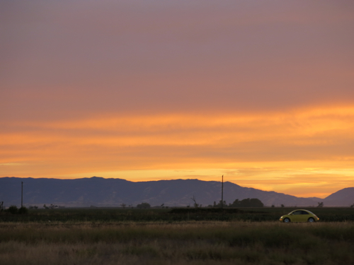
BlogJul2614c

Above: The Coastal Range near Winters, Calif.

Somewhere beyond those purple mountains lies San Francisco Bay, on the edge of which we live; and beyond one last ridge of the Coastal Range lies the Pacific Ocean, extending into vastness beyond the limits of sight. And as we see the sun set behind the mountains, we know that we will not reach our final destination before night settles in on us.
Kearney, Neb., to Rock Springs, Wyo.

Kearney, Neb., is named after Fort Kearny, an army outpost established in 1848 to help protect the emigrants who were using the Oregon Trail in increasing numbers in the middle nineteenth century. As Interstate 80 heads west of Kearney, it roughly follows the old Oregon Trail along the Platte River, crossing and recrossing the Platte on anonymous bridges that you wouldn’t notice except for small signs identifying which channel or branch of the Platte you are driving over at 75 miles per hour. But in his 1847 book The Oregon Trail: Sketches of Prairie and Rocky-Mountain Life, Francis Parkman tells of a very different experience crossing the Platte River:

“The emigrants re-crossed the river, and we prepared to follow. First the heavy ox-wagons plunged down the bank, and dragged slowly over the sand-beds; sometimes the hoofs of the oxen were scarcely wetted by the thin sheet of water; and the next moment the river would be boiling against their sides, and eddying fiercely around the wheels. Inch by inch they receded from the shore, dwindling every moment, until at length they seemed to be floating far in the very middle of the river. A more critical experiment awaited us; for our little mule-cart was but ill-fitted for the passage of so swift a stream. We watched it with anxiety till it seemed to be a little motionless white speck in the midst of the waters; and it WAS motionless, for it had stuck fast in a quicksand. The little mules were losing their footing, the wheels were sinking deeper and deeper, and the water began to rise through the bottom and drench the goods within. All of us who had remained on the hither bank galloped to the rescue; the men jumped into the water, adding their strength to that of the mules, until by much effort the cart was extricated, and conveyed in safety across.”

We stopped at Gothenberg, Neb., to see the Pony Express station. The pleasant woman sitting in the station told us it was relocated from a ranch about thirty miles away, reassembled in the town park, a new roof put on, a brick floor put down, and concrete put between the logs to keep the weather out.

On the way out of town, we stopped at Lisa’s Kitchen for an early lunch. Lisa was outside watering the flowers in front of the restaurant, and she came in to take our order. While she cooked my hamburger, she and I got to talking. I admired the photographs of her grandchildren. There was also a framed photograph of her daughter hanging on one wall, and on the opposite wall a large framed photograph of Lisa, looking quite glamorous and scholarly, from when she lived in Hong Kong. When she heard that Carol and I live in the Bay Area, she said that her daughter lives in the Mission District in San Francisco. She and I agreed that the price of housing in the Bay Area is ridiculously high.

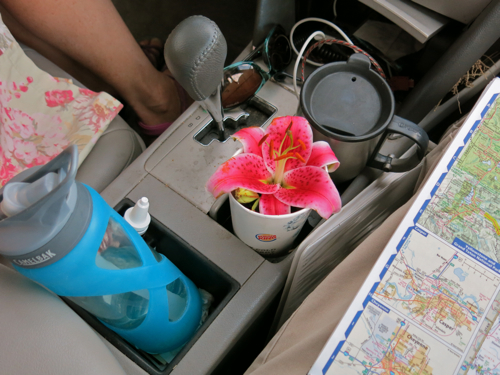
As we were getting in to the car, she waved at us, picked a lily, and came over and gave it to us. The blossom stayed in a large paper cup in the center console of the car for the rest of the day.

BlogJul2414a

We stopped to have lunch at a rest area in Nebraska. We got out of the car, and it seemed warm and windy, but not oppressively hot — just comfortably warm. When I checked the thermometer, however, it read 99 degrees! We were back in the West, where the dry heat isn’t uncomfortable, it just sucks all the moisture out of your body until you feel faint. Carol had washed a pair of pajamas and we hung them out to dry while we were eating lunch, but they were probably dry before we had even opened the jam jar to make our sandwiches.

Before long, trees started to disappear from the landscape, and we began to see sagebrush growing alongside the highway. This was another sign that we were entering the West. The interstate climbed up the western end of Nebraska, we topped one rise and there, off in the blue distance, were the sharp peaks of the distant mountains. We crossed over the border into Wyoming, and soon saw snow-covered peaks. Mark Twain, in Roughing It, described his delight the first time he saw snow-covered peaks in the West:

“Two miles beyond South Pass City we saw for the first time that mysterious marvel which all Western untraveled boys have heard of and fully believe in, but are sure to be astounded at when they see it with their own eyes, nevertheless–banks of snow in dead summer time. We were now far up toward the sky, and knew all the time that we must presently encounter lofty summits clad in the ‘eternal snow’ which was so common place a matter of mention in books, and yet when I did see it glittering in the sun on stately domes in the distance and knew the month was August and that my coat was hanging up because it was too warm to wear it, I was full as much amazed as if I never had heard of snow in August before.”

He had spent several weary weeks in an overland stage before he saw that delightful sight; we had driven just a few days.

We stopped for dinner at a rest area in the Wagonhound region of Wyoming. A sign proclaimed that Indians had used the same spot for a rest area:

“The stone circles or ‘TIPI RINGS’ at this site mark the location of a prehistoric Native American campsite. The stones were probably used to anchor the skins of conical tents, known by the Sioux word ‘TIPI’…. It has been estimated that there are over 1 million tipi rings in the western United States. As such, they are one of the most common archaeological features to be found in this part of the country.”

Certainly, those prehistoric Native people picked a beautiful spot to set up their tipi.

BlogJul2414b

Above: The Wagonhound region of Wyoming

Sagebrush, snow-covered mountains, Indians — one more thing was needed for us to know that we were truly in the West: evidence of major resource extraction. But soon we saw a huge refinery alongside the interstate, out in the middle of nowhere:

BlogJul2414c

Above: Refinery near Sinclair, Wyo.

Then we passed an open pit mine that stretched for over two miles: huge piles of dirt with huge earthmoving equipment crawling over them; the top of a crane emerging from a some deep hole not far from the highway. Now we were truly in the West.

Kearney, Nebraska, to Rock Springs, Wyoming

By the time we got to the Wyoming border, Carol said she was ready to leave Nebraska. I didn’t say so, but I enjoyed the drive through Nebraska. Near Kearney, I liked the way the highway followed the broad flat valley of the Platte River, every so often crossing over one channel of the river or another, passing between green fields of corn and hay fields and lines of trees along the river channels and the very occasional small city. As we got further west, we saw fewer and fewer trees, and more cattle, and here and there a field of golden wheat. The land gradually rose up and up until we were in the high plains, and most of the land was range land. Now and again we passed cattle, mostly clustered around stock ponds in the heat of the day, and I thought about the story that I had read in yesterday’s issue of the Kearney Hub — “125th year, 230th issue”; “At the center of Nebraska life since 1888” — that told how the U.S. Farm Service is going to allow “emergency grazing on about 900,000 acres in Nebraska because of the ongoing lack of forage for livestock”; Western Nebraska is one of the regions where emergency grazing will be allowed, for conditions continue to be drier than normal, even though “conditions appeared to improve at the beginning of the year.”

Once we got into Wyoming, the scenery did get more dramatic. Not long after we passed over the border, we saw sagebrush growing by the side of the highway, and not long after that we saw our first oil derrick bobbing slowly up and down, and then we caught our first sight of tall mountains in the blue distance. We drove past strange rock formations, and watched the railroad wind its way around the sides of hills and buttes. The railroad reminded me of something we saw yesterday: As we drove out of Yankton, South Dakota, before we crossed over the Missouri River on U.S. Route 81, we had to stop at a railroad crossing for two Union Pacific trains to go by; the train headed west consisted of a long line of empty hopper cars, and the train headed east consisted of a long line of hopper cars filled with coal; I suspected that the coal came from the huge Powder River Basin mines on federal lands in Wyoming, since something like eighty train loads of coal come out of Powder River Basin each day.

We stopped in Laramie to visit the food coop there, and stock up on good food. We happened to arrive just when the farmer’s market was taking place, so we wandered around, talking to people in the various booths. Carol got a small bag of summer apples, and some spinach. I got some raw honey and a loaf of olive bread. Carol got some raspberry leaf tea, and an inexpensive necklace made out of a seashell by the nice young man who sold it to her. I found Second Story Books in the next block, browsed for a while, and came away with a biography of Hans-Georg Gadamer, and a book published by the University of Nebraska Press written by a man who had traveled all over the Great Plains for several months, stopping in small towns and talking with whoever came his way. We finally made it to Big Hollow Coop. The man who took our money was from Jackson, California, and had come to Laramie because his girlfriend was in graduate school there. He told us that Big Hollow is the only coop in the whole state, which surprised me; I expected that there would at least be one in Cheyenne.

We stopped to eat our dinner at a highway rest area outside Laramie. It was very windy, but the picnic table had brick walls surrounding three sides, and a wooden roof, so we could shelter from the wind. A pair of Barn Swallows was also taking shelter in the picnic, and they had built their nest up in the rafters; I could just see one swallow’s tail projecting out a little beyond the mud walls of the nest.

We stopped just before sunset at a parking area just before the exit for Creston Junction, Wyoming, and got out to stretch our cramped legs. We looked out over the sagebrush tinged gold by the setting sun, the mountains in the distance now turning pink and purple, the picturesque white clouds — and I realized something out in the sagebrush was looking at me. “See that?” I said to Carol. “An antelope.” She spotted two more. One of them looked at us, saw that we were too far away to be a threat, grazed on some sagebrush, and began moving west; the other two were also moving west, heading towards the setting sun.

BlogJul1913

Heading west

We got a late start this morning, and didn’t leave Van Buren, Arkansas, until nearly noon. After we had been driving a bit, we turned off at a sign that said “Oklahoma Welcome Center,” and turned into the poshest rest stop I think we’ve ever seen. It was staffed by three volunteers. One politely asked me if she could help me with something, and I said, “No thank you, I’m just waiting while she checks email,” pointing to Carol, who was sitting an a very comfortable armchair enjoying the very fast Internet service. “In that case,” she said in her Oklahoma drawl, “I’ll just kill flies,” and, picking up a flyswatter, proceeded to do just that. “Do you keep score?” I said. “No,” she said, “and I’m not doing a very good job, either,” as she missed a fly for the third time.

As we drove through eastern Oklahoma, I noticed that the land looked much greener and much less dry than it had when we drove east a couple of weeks ago. Clearly they had had rain since then.

At exit 200 for Seminole, Oklahoma, we turned off to see if Robertson’s Ham Sandwiches was open. We had seen their distinctive red-and-white billboards heading east, but we had arrived after they closed. They were open. There wasn’t much on the menu but ham sandwiches, so we each had a double ham sandwich for less than five dollars. We sat at one of the wood tables to eat our sandwiches. It was about the best ham I’d ever eaten in a ham sandwich.

We turned off the interstate at El Reno, Oklahoma. Continue reading “Heading west”