Fernley, Nev., to Wendover, Utah

We drove past dramatic scenery today: the Forty-Mile Desert, the green Humboldt River valley in between sagebrush plains, towering 11,000 foot mountains…. But what stays in my mind are the flowers we saw blooming near Pequop Summit.

We parked in the Pequop Summit rest area, elevation 6,967 feet above sea level. We walked over the cattle guard to a dirt road cut into the side of the hill, and then I saw a flower up a fairly steep embankment. I scrambled up to look at it. There was a small Single-leaf Pinyon Pine (Pinus monophylla) just beyond it, then a pale yellow Paintbrush (Castilleja sp.) above that, and then some purple Hooker’s Onions (Alium acuminatum) above that. “Be careful coming down,” said Carol from the dirt road twenty feet below me. I decided that going up was easier than trying to slide down, so I scrambled up to the top of road cut. By now, I was more than thirty feet above the highway, so I must have been over seven thousand feet.

It was beautiful up there. At seven thousand feet above sea level, it was still springtime. Flowers were blooming everywhere. In some places you couldn’t move without stepping on a flower. In among the pungent-smelling sagebrush (Artemisia sp.), sprightly yellow Groundsels (Packera sp.), like tiny little yellow daisies, grew next to low-growing Lava Asters (?) (Ionactis alpina). The Mule’s Ears (Wyethia sp.), with their leaves like the ears of mules and their flowers like little sunflowers, were mostly past their prime, but in the shade of some big sagebrush bushes a few sheltered plants were still in full bloom.

The yellow flowers are Hawksbeard (Crepis sp.), the red ones are Paintbrushes (Castilleja sp.), and the small purple ones are Hooker’s Onion (Allium acuminatum)

In addition to the flowers, small grasshoppers were buzzing and jumping all through the scrubby growth. Birds sang throughout the sagebrush, and as I approached them were apparently surprised that a human was walking through their territories.

All this was happening within sight and sound of Interstate 80. Most of this was happening below the level of my waist. I was so fascinated by the sights, sounds, and smells that I never even looked up to admire the view from Pequop Summit, if there was indeed a view.

Eriogonum sp.

Earlier in the day, we had stopped for a rest break near Oreana, Nev. This was at a much lower elevation, and I didn’t expect to find any flowers in bloom. But I walked a little way down a dry wash, and there found two or three clumps of Desert Prince’s Plume (Stanleya pinnata) blooming. Pollinators swarmed around these flowers, including a Western Pygmy Blue butterfly.

Western Pygmy Blue (Brephidium exilis)

In Oreana as at Pequop Summit, I barely noticed the grand landscape scenery around me: my attention was on the small, intimate landscape at my feet.

My iNaturalist observations for June 21

Winnemucca, Nev., to San Mateo, Calif.

“At the border of the [Great American] Desert,” said Mark Twain, “lies Carson Lake, or The ‘Sink’ of the Carson, a shallow, melancholy sheet of water some eighty or a hundred miles in circumference. Carson River empties into it and is lost — sinks mysteriously into the earth and never appears in the light of the sun again — for the lake has no outlet whatever.” Although I had no interest in walking forty miles across the Great American Desert, without water, as Mark Twain had to do when he was taking the stage coach to Carson City, Nevada, I was interested in seeing the Carson Sink, so I left the interstate highway and drove down U.S. 95. There was no water in the Carson Sink when I drove through, just thousands of acres of bleak desolate salt-encrusted, dried-up mud. The Bonneville salt flats west of Great Salt Lake in Utah are pristine white and shine in the sun, and look sublimely beautiful; but the Carson Sink looks like dirty snow, with more dirt than snow, and looks merely grim.

South of the Carson Sink, the land rose, and grew greener and greener, and there were ranches on either side of the highway, and then I was in Fallon, Nevada, the self-proclaimed “Oasis of Nevada.” I turned east on Nevada Route 116, drove some ten miles through hay fields and ranch lands, passed through the little hamlet of Stillwater, and then out into the 77,000 acre Stillwater National Wildlife Refuge. East of Stillwater, the land grew steadily drier and less hospitable, and it seemed like the only vegetation was clumps of black greasewood (Sarcobatus spp.).

Stillwater NWR, Sarcobatus spp.

When I went around a bend in the road and suddenly saw open water, I thought at first that I was seeing those heat mirages so common in the Nevada desert. But no, it really was open water, surrounded by tule rushes and cattails.

BlogJul3115b

The Stillwater marshes provide breeding grounds for many birds, and I saw juveniles of several species, including American Coots, Eared Grebes, Pie-billed Grebes, Ruddy Ducks, and various kinds of swallows. I saw Great Blue Herons, Loggerhead Shrikes, Snowy Egrets, Virgina Rails, White Pelicans — and watching huge White Pelicans glide in graceful formation against the backdrop of distant rugged desert mountains was a sight worth seeing. There were other animals in and around the marsh, too — lizards, and some hidden animal, probably a muskrat, that moved noisily among the rushes just at water level about five feet from where I stood, and and half a dozen jackrabbits.

Jackrabbit, Stillwater NWR

Mark Twain calls this animal a jackass rabbit: “He is well named. He is just like any other rabbit, except that he is from one third to twice as large, has longer legs in proportion to his size, and has the most preposterous ears that ever were mounted on any creature but a jackass.” One of the jackass rabbits I saw started from cover when I got too close, stopped when i froze and stared at me with big black and yellow pop-eyes, let me take a photograph of it, then started suddenly and bounded away and lost himself among the clumps of greasewood.

When I got to Stillwater National Wildlife Refuge, the sky was overcast, and the temperature was about 85 degrees — a very pleasant temperature in the dry desert air — but slowly the sun came out and the temperature climbed up to 97 degrees, and there wasn’t any shade to speak of, and I decided it was time to move on. When I sat in the car, almost instantly my back grew wet with sweat; it had been so dry that my sweat dried almost instantly as long as the air could get to me, but once the air was blocked off it soaked my shirt.

From North Dakota to central Nevada the highways are lightly traveled and there were many times when I couldn’t see another vehicle in front of me or behind me. But from Reno to the Bay Area, the highways are heavily traveled, and they wind and twist and go up and down abruptly, and I had to dodge the occasional crazed driver (all of whom seemed to have a California license plate) who thought it great sport to suddenly change lanes and dodge in front of me and slow down and speed up with no apparent rhyme or reason. Driving was no longer enjoyable, and I settled down to suffer.

From Maine to California, I had periodically been monitoring 29.600 MHz, the amateur radio national calling frequency for FM simplex, and in all those miles and hours had heard nothing but static. The driving required too much of my attention to want to try to listen to an audiobook, so I turned on the little 10-meter band radio and started listening to static. Just east of Sacramento, I realized I was hearing someone giving a call sign with a Hawai’i prefix. I replied, he heard me, and I wound up talking to Norm, who lives on the Big Island, some 2,450 miles from Sacramento. Traffic got bad so I had to end the contact — and of course by the time traffic got more reasonable, ten miles west of Sacramento, I could no longer hear Norm, and there was nothing but static once again.

And here I am, back home once more. I like the fact that I don’t have to worry about driving six or seven hours a day any more. I like seeing Carol again. I’m even looking forward to going back to work on Sunday. But I wish vacation weren’t over.

Pocatello, Idaho, to Winnemucca, Nev.

The day did not start well. I awakened in the midst of a dream about work — you know a vacation is almost over when thoughts of your job work their way into your dreams. And then when I got to the Minidoka National Wildlife Refuge in mid-morning, I found out that I would need a high-clearance vehicle to access the interesting parts of the refuge. So I drove on towards Winnemucca, trusting to luck.

I followed a sign pointing to Shoshone Falls, and pulled over at the Hansen Bridge overlook. The view from the little parking area was dramatic — the bridge crossing a nine hundred foot wide canyon some four hundred feet above the Snake River. I thought that maybe if I kept walking on the adjacent Bureau of Land Management property, the view up the canyon towards the bridge would be even more dramatic, and it was. I climbed down and out on the volcanic rock of the canyon rim and watched Swainson’s Hawks and Red-tailed Hawks circling far below me, startling flocks of Rock Pigeons roosting in holes in the cliffs as they circled past.

Hansen Bridge over the Snake River, near Twin Falls, Idaho

Then I looked down the canyon, and that view was also dramatic: the canyon became broader, and the river divided into several streams, flowing around islands in the middle of which were buttes, the green of the riparian corridor making a strong contrast with the harsh black cliffs of the canyon walls. I walked around for three quarters of an hour, entranced by the view down into the canyon.

BlogJul3015b

At last I drove on to Shoshone Falls. There isn’t enough water in the summer to make the falls truly dramatic, but they were dramatic enough. I was almost more interested in watching the tourists watch the falls, than in watching the falls themselves. I thought about walking up the trail to where Evel Kneivel jumped his motorcycle across the canyon, but instead drove up to Dierke’s Lake, which lies in a large flat bench partway down the canyon. The swimming area was swarming with people, including lots of children; it was a friendly, homey scene. I walked up past the swimming area and wound up talking with a man from San Jose who was taking his daughter to tour colleges.

From there, I drove on, stopping briefly in Jackpot, Nevada, where I chatted with the cashier at the grocery store where I bought my lunch-time caffeine; she said Jackpot was the kind of small town where you knew everyone, though she admitted that winters could be kind of long. I ate my lunch at a highway rest area by the side of a stream. Of the three picnic tables in the rest area, two were occupied by single men who appeared to have a lot of possessions with them; one of them had a friendly chat with the workers who stopped to empty the trash cans and restock toilet paper at the pit toilets. I assumed these two men lived in or around that remote rest area.

In Wells, Nevada, I stopped at the Emigrant Trail Center, and talked with the volunteer who was staffing it today. He had grown up in Wells, which began as a railroad town — his parents worked for the railroad — and when the railroad reduced its operations in the late 1960s, jobs shifted to supporting the new interstate highway that came through town. The ranchers in the area, he said, also contributed a good deal to the local economy. After the earthquake of 2008, which destroyed many of the old historic brick buildings in the town, a vein of gold was discovered, and plans are now being made to mine that vein — which, he hoped, would add more jobs to the local economy. On my way out of town, I stopped to take a picture of the Community Presbyterian Church, which — so said my friend who grew up in Wells — had stood for more than a century, pretty much unchanged.

Wells, Nev., Community Presbyterian Church

Only one more day to vacation. I’m looking forward to getting back to see Carol. I’m even looking forward to getting back to work — but even so I wish this trip were not going to be over so soon.

Winnemuca, Nev., to Evanston, Wyo.

This morning, I had a hard time getting on the road; a week’s worth of twelve-hour days running Ecojustice Camp finally caught up with me. I was a little bleary when I started driving. Yesterday in a truck stop I had found an audiobook, on CDs no less, of Isaac Asimov’s I, Robot, and I put the first disc into the car’s CD player. When I was in high school, I had loved I, Robot; I found I still liked it, even though there were huge holes in the plot, even though Asimov doesn’t appear to like women very much, even though he mixes slide rules and space ships; I liked it even though the characters were caricatures, but they were engaging caricatures.

At some point after I passed through Battle Mountain, I began to notice how green the mountains looked — green by northeastern Nevada standards, that is. It had obviously rained in the recent past. Then I began to notice the banks of yellow flowers along the edges of the interstate; I could not only see them, but in a few places I could feel the pollen in the air. They ere so stunning in that desert landscape that I finally pulled over at the exit ramp to Welcome, Nevada, and photographed them. They looked bright and dramatic against the freshly green sage brush.

BlogJun2815a

I rolled through dreary little West Wendover, Nevada, its faintly shabby casinos looking even more shabby in that huge landscape, with towering mountains, and the white expanse of the salt flats stretching eastward into the haze. I rolled across the salt flats — stopping briefly to eat a sandwich in the shade of the rest area in the middle of the salt flats — across the plains and hills on the other side, and got off at the Dugway exit. The directions said to head north, take an immediate left, go a third of a mile, then take the right fork. But the road didn’t fork, it terminated in the exit gate of a huge Cargill salt facility, with a railroad siding and towering piles of salt. Finally I figured out that what I was supposed to do was to turn right at the gates to the Cargill plant, and sure enough there I was at the entrance to Timpe Spring Wildlife Management Area.

One moment I was between the railroad siding and the salt plant, and the next moment I was driving along a narrow dirt road looking out at American Avocets and Black-necked Stilts squawking at me, and California Gulls soaring purposefully overhead towards Antelope Island, which loomed out of the invisible Great Salt Lake in the distance, and a Northern Shoveler dabbling at the edge of the marsh with that absurdly long bill it has.

BlogJun2815b

I started walking out across one of the dikes, but Forster’s Terns and Black-necked Stilts began circling closer and closer to me, and Song Sparrows came up out of the brush at the edge of the dike, all of them giving calls of alarm. Obviously, I was getting too close to their nests. So I walked out along the other dike, but soon an American Avocet and a Wilson’s Phalarope came out of the marsh grasses giving their calls of alarm, so I retreated once more. By that time, I had been walking around for most of an hour, and the temperature was one hundred degrees even, and I was longing for a drink of water. I walked back to the car.

The birds were not so bothered by me while I was in the car. I drove out very slowly, stopping several times to see if I could see the nests of the American Avocets and the Black-necked Stilts, but I could not; the nests must have been well down in the marsh grass. I swatted one last biting fly, slow and stupid from the heat, that had landed on my face, rolled up the window, and drove on to Evanston, Wyoming.

BlogJun2815c

Elko, Nev., to San Mateo, Calif.

Nights get cool in the dry desert air of Elko, and we left the window of the motel room open all night. We got on the road while the air was still cool. We were about to turn on the audiobook we have been listening to — Chaucer’s Canterbury Tales, in the translation by Burton Raffles — when I saw a sign by the side of the road: “California Trail Interpretive Center.”

“Do you mind if we stop there?” I said to Carol. She knew that I have become mildly obsessed with the California Trail on this trip, so she agreed we could stop.

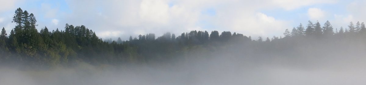
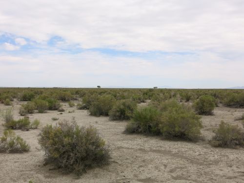
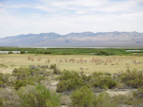
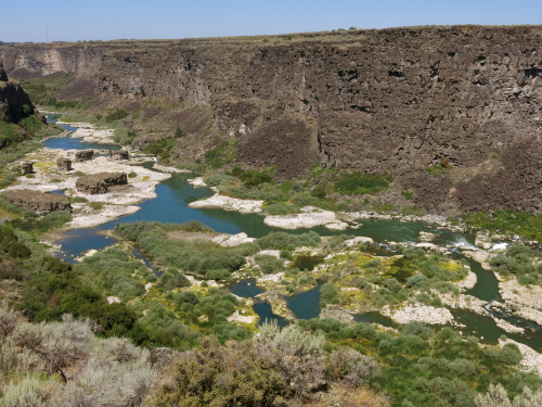
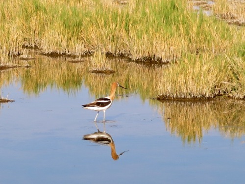
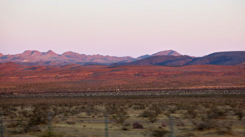
We climbed up the short trail behind the Interpretive Center building, and looked down on the Humboldt River valley: the narrow river winding along the low point of the broad valley; bright green grass and even a few trees growing near the river; the green grass giving way to sagebrush as the land sloped up away from the river; and then, rising more and more steeply above the level of the sagebrush, the stark and almost bare slopes of towering mountains.

BlogJul2614a

Above: The Humboldt River valley east of Elko, Nev.

Edwin Bryant, in his 1848 book What I Saw in California, described how his party made the difficult crossing of the salt flats west of Great Salt Lake, and then made their way across the often steep and difficult terrain of what is now western Nevada, finding barely enough water, and barely enough grass for their mules, at widely spaced springs. After more than a week of travel through this harsh desert, Bryant and his party found a small tributary stream which finally led them to the Humboldt River (which they called Mary’s River):

“We emerged into the spacious valley of Mary’s River, the sight of which gladdened our eyes about three o’clock, P.M. At this point the valley is some twenty or thirty miles in breadth, and the lines of willows indicating the existence of streams of running water are so numerous and diverse, that we found it difficult to determine which was the main river and its exact course…. At sunset we encamped in the valley of the stream down which we had descended, in a bottom covered with the most luxuriant and nutritious grass. Our mules fared most sumptuously both for food and water.”

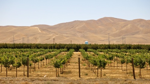
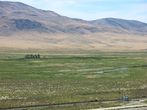
Today, the Humboldt River valley looks somewhat different than it did in Bryant’s day: the river has been restricted to one main channel; most of the trees are gone and the river bottoms are used by farmers to grow feed for cattle; cattle graze on sagebrush above the river bottom; and the interstate highway and a railroad run between the agricultural land and the grazing land. But even in this time of interstate highways and air conditioned automobiles, I still found the green of the valley to be a welcome sight in the midst of a land that appeared to me to be dry and forbidding landscape.

My perception of this land as dry and forbidding is not shared by the Te-Moak Tribe of Western Shoshones. On their tribal Web site, they write: “This vast land of mountains, valleys, deserts, rivers, and lakes offered an abundance of wildlife and plants for the Shoshone to hunt, fish, and gather. The Newe [the name by which they call themselves] knew their lands and cared for its natural balance; for them it was a land of plenty.” And, Steven J. Crum, in his book The Road on Which We Came: A History of the Western Shoshone (Salt Lake City University of Utah Press, 1994), quotes a Western Shoshone song:

“How beautiful is our land,
how beautiful is our land,
forever, beside the water, the water,
how beautiful is our land.

“How beautiful is our land,
how beautiful is our land,
Earth, with flowers on it, next to the water,
how beautiful is our land.”

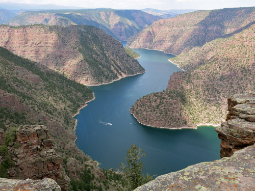
We kept driving west, generally following the course of the Humboldt River, for the next two or three horus. Bryant and his party followed the Humboldt River for more than a week, from August 9 through August 19, when at last they reached the Humboldt Sink — that place where the river terminates:

“We came to some pools of standing water, as described by the Indians last night, covered with a yellowish slime, and emitting a most disagreeable odor. The margins of these pools are whitened with an alkaline deposit, and green tufts of a coarse grass, and some reeds or flags, raise themselves above the snow-like soil.”

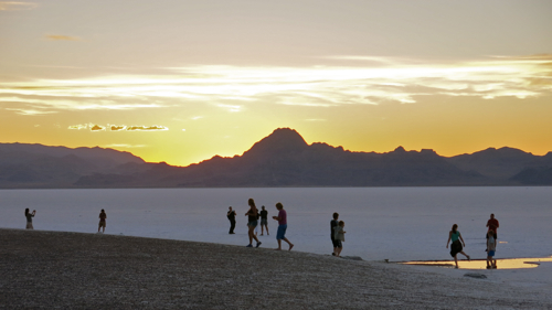
The Humboldt Sink is another weird landscape, forty-five miles of undrinkable water, halophytes or salt-loving plants, whitish soil — and forty-five miles of misery for the early travelers along the California Trail. The Western Shoshone appear to have been smart enough to stay out of the Humboldt Sink. But the white emigrants had to cross it in order to get to California. Mark Twain had to cross it in his 1861 trip by stagecoach in order to get to his final destination of Carson City:

“…forty memorable miles of bottomless sand, into which the coach wheels sunk from six inches to a foot…. It was a dreary pull and a long and thirsty one, for we had no water. From one extremity of this desert to the other, the road was white with the bones of oxen and horses. It would hardly be an exaggeration to say that we could have walked the forty miles and set our feet on a bone at every step! The desert was one prodigious graveyard. And the log-chains, wagon tyres, and rotting wrecks of vehicles were almost as thick as the bones. I think we saw log-chains enough rusting there in the desert, to reach across any State in the Union. Do not these relics suggest something of an idea of the fearful suffering and privation the early emigrants to California endured?”

BlogJul2614b

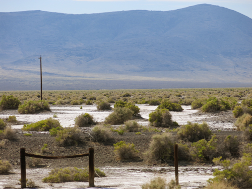
Above: The Humboldt Sink near Interstate 80 in Nevada

Why did those early emigrants make that trip? — traveling west for hundreds of miles into uncertainty. The emigrants may have been able to give rational explanations of their desire to emigrate; but, suggests historian George R. Stewart, there were other, non-rational, factors at work:

“We may suspect some unconscious motivation. Moving was an established folk custom. Most of these people had already moved once, or oftener, and to do so again was only natural. Moreover we may suspect that many of them were driven on by mere boredom. To exist for a few years on a backwoods farm with almost no means of amusement or stimulation meant the build-up of an overwhelming desire to see new places and people.” (The California Trail [New York: McGraw Hill, 1962].)

It seems a little extreme to suggest someone would travel that far into such uncertainty out of boredom; Mark Twain was driven to emigrate to Nevada out of a species of boredom, but that was later, when there was regular stagecoach service across the continent. But boredom is related to other human feelings, including religious feelings — what is meditation, but organized boredom? — and as meditation is related to boredom, so are both related to ecstasy. The early travelers along the California Trail must have endured mind-numbing boredom at some stages along the trail; but in other places they experienced the terrifying sublimity, the awe-inspiring grandeur, of the land; the awe and sublimity and terror amplified by partial starvation and fear and exhaustion, and their earlier boredom. We drove most of the day through the Nevada landscape on not enough sleep, we were sometimes bored by driving, and we were awe-struck by the sight of the mountains and canyons; terrified by the steep winding downgrades; horrified by the sight of a fire-blackened hulk of a truck that we passed in slow single-file line of vehicles as fire fighters put out the last of the brush fire that the explosive burning of the truck had started, passed in horrified realization that no one could possibly be left alive after that crash and fire, that crash that obviously came from the truck losing control on one of those steep winding downgrades that we were now negotiating. The emigrants had far more intense experiences that lasted far longer, and extended over months. Such things work changes on one’s being.

On the other side of the Humboldt Sink, the interstate roughly follows the Truckee River — again, one of the routes of the California Trail, a route that guaranteed fresh water and forage for oxen and mules. We stopped at the rest area at Donner Pass — this rest area is not far from where the ill-fated Donner party were snowbound, and where nearly half the party died — and to stretch our legs we walked a short distance along the Pacific Crest Trail.

There we met a man who was through-hiking the Pacific Crest Trail. He was older than the typical through-hiker, ten or twelve years older than I, and since we were near contemporaries of his, it was easy to wind up talking with him. He told us about walking 700 miles through the desert, sometimes having to carry enough water to last him for 30 miles. When he got to the high Sierras, the altitude hit him hard, slowing him down until he became finally acclimated. Carol asked about the logistics of renewing his supplies, and he said that once he had to walk a full day, or about fifteen miles, off the trail to pick up supplies, and then walk a full day to get back on the trail.

His motivation for taking on such a physically and mentally challenging trip was simple: his son was killed in an accident, then his wife died, and he had to do something. We talked about what might motivate other through-hikers. “We’re listening to The Canterbury Tales as we drive,” I said, “and I think through-hiking is a kind of modern-day pilgrimage.” Through-hikers have no pilgrimage destination, no Canterbury with Saint Thomas’s remains at journey’s end; there is only the journey. But like the pilgrims going to Canterbury, and like the emigrants, they begin their journeys with the advent of warm weather:

“When Zephyrus eke with his swoote breath
Inspired hath in every holt and heath
The tender croppes and the younge sun
Hath in the Ram his halfe course y-run,
And smalle fowles make melody,
That sleepen all the night with open eye,
(So pricketh them nature in their corages);
Then longe folk to go on pilgrimages….”

So, too, I began to long for this cross-country trip in the early spring, looking through the road atlas to choose a route, making plans about where we would stop, dreaming about when we could start driving.

All pilgrims must complete their journeys before the harsh weather of winter sets in. Our through-hiker worried that he might be walking too slowly, he might not make it through the mountains of Washington before the winter snows set in. I said I wasn’t sure that mattered, and he allowed that the journey was what he most wanted, and needed.

As for us, our journey is almost complete. Our journey has been relatively comfortable: riding in a car, stopping when we feel like it to take a walk or look at scenery, sleeping in motels. Our journey has been relatively quick: a matter of days, not weeks or months. But as we drove down out of the Sierra Nevadas, down into the wide Central Valley, through the traffic of Sacramento, I feel a change in myself — not enough of a change, but a change. That’s what the early emigrants on the California Trail were looking for: a change; a change in circumstances, but also I think an inner change. Mark Twain was looking for a change in circumstances when he went by overland stage to Carson City, Nevada, and after seven years in the West found that what had changed most was — not external circumstances — but himself.

We kept on driving west, driving towards the sun setting over the Coastal Range, the western-most range of mountains in this part of North America.

BlogJul2614c

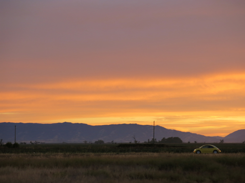
Above: The Coastal Range near Winters, Calif.

Somewhere beyond those purple mountains lies San Francisco Bay, on the edge of which we live; and beyond one last ridge of the Coastal Range lies the Pacific Ocean, extending into vastness beyond the limits of sight. And as we see the sun set behind the mountains, we know that we will not reach our final destination before night settles in on us.

Rock Springs, Wyo., to Elko, Nev.

We made a detour to Red Canyon, part of Flaming Gorge National Recreation Area. For an hour and a half, we walked through Ponderosa pine woods, stopping now and again at one of the overlooks set up to offer perfect picture postcard views of the sheer red sandstone walls of the canyon dropping a thousand feet down to the perfect emerald water of the reservoir. It is almost impossible to take a bad photograph of Red Canyon.

BlogJul2514a

Above: Red Canyon, Flaming Gorge National Recreation Area in Utah

We drove back to the interstate, across broad sagebrush-covered plains, down steep, twisting roads, emerging every once in a while into valleys that were bright green with irrigated agricultural fields.

Sagebrush and mountains dominated the landscape. The interstate plunged down into Echo Canyon, historic route of the Hastings Cutoff on the California Trail. Somewhere in Echo Canyon there are the remains of stone breastworks erected by early Mormons as an act of defiance, as they prepared for an invasion by the U.S. Army; the army had spent months moving its troops westward and was camped out for the winter near Fort Bridger, Wyoming, prepared to forcibly extend the territorial rule of the United States over the Mormon theocracy. Open war was averted, barely. Eventually the coming of the railroad changed the political landscape, by making it far more difficult for the Mormon hierarchy to remain so isolated — and by making it obvious to all concerned that the U.S. Army could mobilize forces, not in a matter of months, but in a matter of days.

We stopped at a rest area in Echo Canyon, and climbed a fifty-foot high hill that was covered in sagebrush bushes ranging in height from two feet to the extraordinary height of seven feet. I looked at one of the seven-foot-high sagebrush bushes. Mark Twain was right; squinting my eyes and using my imagination, the sagebrush turned from a small bush into a huge old tree towering over me:

“If the reader can imagine a gnarled and venerable live oak-tree reduced to a little shrub two feet-high, with its rough bark, its foliage, its twisted boughs, all complete, he can picture the ‘sage-brush’ exactly. Often, on lazy afternoons in the mountains, I have lain on the ground with my face under a sage-bush, and entertained myself with fancying that the gnats among its foliage were liliputian birds, and that the ants marching and countermarching about its base were liliputian flocks and herds, and myself some vast loafer from Brobdignag waiting to catch a little citizen and eat him.”

BlogJul2514b

Above: Seven-foot high sagebrush in Echo Canyon, Utah

As we drove along, I compared our route on a map of the California Trail published by the National Park Service; I also looked at the official highway map of the state of Utah, which shows the historic route of the Hastings Cutoff of the California Trail, in greater detail and with more accuracy than the Park Service map. After Echo Canyon, the Hastings Cutoff went north of present-day Interstate 80. Leaving Salt Lake City, the interstate crosses a part of Great Salt Lake that is often dry, while the Hastings Cutoff followed higher ground along the base of Oquirrh Mountain, then in along the Tooele Valley, and up over Hastings Pass. The old trail passed by some fresh water springs, crossed over the present route of Interstate 80, then across great slat flats.

BlogJul2514d

It’s hard to imagine what it must have been like to cross the utterly flat and utterly white salt flats in the days of the California Trail — neither fresh water nor forage for the oxen or humans, blinding sun above reflected by pure white salt underfoot — it seems impossible; yet people did it.

We drove at 75 miles per hour along a perfectly straight and level highway, watching the sun slowly sink towards the mountains on the Nevada side of the salt flats. We got to the rest area on the western edge of the slat flats just before sunset, and took innumerable photos of the subtly changing light in the sky, on the distant mountains, on the salt flats themselves. The beauty of the scene was tamed by the knowledge that we could get back into our automobile, and within minutes be sitting in an air conditioned restaurant in Wendover, drinking fresh water; without that sense of physical safety, the beauty would better be described as sublime and awe-inspiring.

We watched the shifting color, but we also watched the dozens of people who pulled their car or truck or RV into the rest area, and leaped out, camera or smartphone in hand, to take as many photos as we were taking. A family group came out of two rental RVs speaking Polish, children running across the slat flats, adults staring and taking photo after photo. A trucker walked swiftly to the edge of the slat flats, holding up his smartphone to take photos. And off to one side, half a dozen people took part in some kind of photo shoot: a woman in a long red dress, a girl holding a bright pink helium balloon, a photographer with a backpack and cameras slung around the neck.

BlogJul2514c

San Mateo to Needles

We left San Mateo in the middle of the morning, drove down through San Jose and Gilroy, and up over Pacheco Pass into the Central Valley. There’s a grayish-brown cast to the landscape of the Central Valley, and everything looks dry and dead — except where the land has been irrigated for crops.

BlogJun2214a

Above: Interstate 5, near Lost Hills, Calif.

We’re now in the third year of a severe drought across California. In a few places, acres of trees had been uprooted and left to die, perhaps because they use too much water. On the fences surrounding many agricultural fields were signs protesting any possible reduction in water allotments to agribusiness and farming interests: “No Water = No Jobs,” “Stop the Congress-created Dust Bowl,” etc.

We turned east onto Route 58 through Bakersfield, climbed over the mountains at Tehachapi, heading towards the Mojave Desert. “There’s a Joshua Tree!” I said to Carol, pointing out the car window. The sometimes contorted shapes of Joshua Trees, their arm-like branches, make them seem like beings that are about to move, to turn and point at you.

On a map, it looks like there isn’t much in the desert, but it is far from empty. There’s the highway; there are mysterious industrial plants in the middle of the desert; there are power transmission lines everywhere; there is Edwards Air Force, with its planes, and strange structures on the tops of high mountains; there’s the historic Southern Pacific rail line, now owned by BNSF, with several mile-long freight trains per hour; and there are the Joshua Trees.

BlogJun2214b

Above: Near Boron, California

In Barstow, we stopped at the Canton Diner for dinner. Carol asked our white waitress if she could get just plain vegetables. The waitress went and got a middle-aged Chinese man from the front desk. Carol explained that she wanted just some plain stir-fried vegetables. He disappeared, and came back in a moment with some uncooked Chinese broccoli, and something that looked like amaranth, to show to her. She choose the Chinese broccoli. “Any meat?” he asked. “No, thank you,” she said apologetically, “I just want some vegetables.” “A little garlic?” he asked. “Sure,” she said. When the plate of stir-fired Chinese broccoli came, it was as good as anything you might get in San Francisco’s Chinatown.

When the man brought us the check, I asked him if he were from Hong Kong. “Yes,” he said, looking a little surprised, “why do you ask?” “You have just a little bit of an English accent,” I said; and he was old enough to have completed his education while Hong Kong was still a British possession. He smiled, and when we walked out, he bid us a pleasant good-bye.

BlogJun2214c

Above: Canton Diner, Barstow, Calif.

East of Barstow, the landscape grew emptier, though the rail road was still nearby, transmission lines crisscrossed the landscape, and there were still mysterious-looking plants here and there in the distance. The setting sun turned the landscape a warm glowing red.

BlogJun2214d

Above: Along Interstate 40 east of Newberry Springs, Calif.

We pulled in to Needles at 9:20; it had gotten up to 108 in the middle of the day, and the temperature was still in the mid-90s. The first time I came to Needles, I had just read a biography of Charles Schulz, the cartoonist. He had spent three years of his childhood in Needles, and hated it. It was cold during the winter, so cold he could hear rocks cracking; and during the long summer it was brutally hot, sometimes not getting below 90 at night. But I liked Needles: I liked the small-town feel, I liked the newspaper that’s been continuously published since 1888, I liked the stark desert landscape surrounding the town. I liked it enough that I keep coming back.

The only reason Needles existed when Charles Schulz lived here as a boy was because of the railroad. It’s still a railroad town, and it’s still a small town, with fewer than 5,000 residents. Carol and I took a walk down to the Amtrak depot. A man was standing on his front porch, and we said hi. “Nice and warm,” I said to him. “It’s a lot cooler now than it was,” he said, and we both chuckled. If it weren’t for the climate, it might be a nice place to live.

Parker, Arizona

We stopped in Parker, Arizona, on the drive home from Phoenix.

We visited the Colorado River Indian Tribes Museum, which has artifacts from the Mojave, Chemehuevi, Hopi, and Navajo peoples. Carol and I have been reading The Blue Tattoo: The Life of Olive Oatman, a book about a White girl who was adopted into the Mojave tribe in the 1850s, so I was particularly interested to see a Mojave bark skirt on display, presumably similar to the one Olive Oatman would have worn. In the gift shop, they were selling a Red Sox blanket, and I asked why. “Jacoby Ellsbury plays for the Red Sox,” said the pleasant young man at the cash register. “He’s enrolled in the Colorado River Indian tribes.”

Carol went to a thrift store. I stopped to admire the engine facility of the Arizona and California Railroad, a shortline railroad that runs from Phoenix to Cadiz, California, and owns a bridge across the Colorado River.

Carol hugged a saguaro in a public park in Parker.

We drove across the Colorado River, and on the other side we stopped at the tiny U.S. Post Office for Wyatt Earp, CA 92242. Of course we mailed some postcards, making sure they were hand-cancelled with that distinctive name.

Sonoran Desert

We drove into Arizona towards Phoenix along Interstate 10. We knew we had entered the Sonoran Desert when we saw giant saguaro cacti along the side of the highway. A roadrunner ran quickly across the highway in front of us, moving so fast I didn’t have time to touch the brakes before it was lost in the brush on the other side. The Sonoran Desert is a beautiful place.

Halfway Phoenix from the California border, the sprawl began to replace the desert: tract houses, malls, light industrial buildings, the occasional agricultural field, a golf course here and there.

In large part because of its beauty and lushness, more Arizonans live in the Sonoran Desert than in any other geographic region of the state: more than three-fourths of our total of four million people. This crush of bodies, with the pressures they impose on the desert’s modest resources, is the state’s most ominous problem. — Lawrence Cheek, Arizona (Compass Travel Guides, 1995), pp. 34-35.